By
Larry Pearce
6/7/03
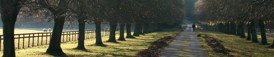
Looking westward across the magnificent blue expanse of the Quemahoning Reservoir in northern Somerset County from along the narrow Pennsylvania legislative route that encircles it, one can see a stately old white farmhouse and large barn toward the top of the hill behind which the sun sets. The trees and bushes crowd the “gentleman’s” farmland everywhere now, but one can imagine how open and productive this valley must have been a century ago. Originally the home of a small band of Shawnee Indians who found the hillsides abundant with game, large and small, and the little stream teeming with fish, this space over the Allegheny Mountain became the homesteads of several German settlers, and a few English, who came from their first establishments in eastern Pennsylvania, Berks and Lancaster Counties, to farm what was then western Bedford County. Many of the family heads had fought in the American Revolution and claimed the land either through “Tomahawk” or “Walk Around” rights just after the war or as “Depreciation” property after the Ft. Stanwix Treaty of 1784 and the Ben Franklin Plan of 1792 [see article “Pittsburgh in 1820 and Beyond” ]. Our family patriarch, Joseph “Yost” Miller (1748-1811), settled just a few miles south of the Quemahoning Dam area in the Beaver Dam or Silver Valley in 1784 [see “1910 Article to ‘Yost’ Miller Descendants”]. His great-great-great grandson Howard Pearson Miller (1885-1969), my wife Susan’s grandfather, married the daughter of Franklin Baer (1862-1916), Sarah Jane (1891-1972), and they took over the Baer farm, the one mentioned above that overlooks the Quemahoning, sometime just before the first World War. Their farm escaped the timbering, the dredging, and the floodwaters that led to the construction of the dam site, because it was so high up. But, this story is about those farms, businesses, and homes that weren’t so fortunate and, today, are under water, anywhere from a few feet to over 100 feet.
Several years ago, before the bankruptcy and sell off of the giant Bethlehem Steel, which at one time accounted for as many as 20,000 jobs in the region, the company decided to repair the Quemahoning spillway. This required lowering the water level of the lake considerably, which at its construction in 1911 was the largest man-made body of water in Pennsylvania. According to Pete Bosak, then Somerset Bureau Chief of the Tribune-Democrat, “At least 20 foundations from an era long ago [could] be seen, explored, and appreciated.” One of the natives who took the opportunity to explore was The Rev. Beverly Good, pastor of the Maple Spring Church of the Brethren in nearby Jerome. He discovered the rock foundation of the building, the Pine Grove Church, from which his own congregation descended: “The water of the dam clearly covers up some of our history. What’s under the water tells the history of America.”
Bethlehem Steel began in Johnstown as the Cambria Iron Works, which found the area ideal because of the abundance and easy access to its basic need, iron ore, and great tracts of timber that could be reduced to charcoal for smelting the ore. [Our present property at Forwardstown sits on the site of the county’s first iron works called Somerset Furnace, which began operations around 1850. See Eggert’s history of iron making for more details.] Later some the area’s great coal reserves were reduced to coke for similar purposes. All of this, including the earliest transportation of the pig iron ingots by barge to Pittsburgh, required lots and lots of pure water, and this valley had plenty. Around the turn of the 19th Century, with American industrial expansion, the push of the population and railroad westward, and a war with Spain, Bethlehem Steel needed an ever larger, more continuous, and year-round reliable source of water. The ideal location was near the headwaters of the Stonycreek River, which along with the Little Conemaugh [the path of the Great Johnstown Flood of 1889, America’s most deadly inland natural disaster that left over 2,000 dead in a single after the collapse of the South Fork Hunting and Fishing Club Dam], meets at the Bethlehem mill to form the Conemaugh River [of Allegheny Portage Railroad and Pennsylvania Canal fame]. So the company began buying land in northern Somerset County to construct an enormous dam and lake. Many families, including some relatives, had to pack up and move. Rev. Good thinks the buildings were torn down and the trees stripped away so that the wood wouldn’t eventually surface and clog the spillway. But the foundations and stumps remained. Some revenue was probably generated from the sale of the boards, beams, and timber, but maybe only enough to pay the workers.
Rev. Good stumbled upon a pile of old “cut” nails [forged, flattened, and stamped from long strips of iron rather than poured and shaped individually as they are today]. They had undoubtedly held the old Pine Grove Church together and were unrusted after over three-quarters of a century under water because of the lack of an oxidizing agent. This church had been built before the American Civil War, the same year as my wife Susan’s great grandfather Dibert Miller was born, 1855. He was a Lutheran, we believe, and farmed mosre to the south near Stoystown. Good related, “We have records of some of our [Church of the] Brethren being baptized in the valley with Pine Grove Church.” He also learned that the wood from the old structure went to build a farmhouse on higher ground. This is supposedly still standing. Who knows, it could be the old Baer-Miller house.
One of the 20 foundations beneath the Quemahoning is that of Stanton’s Mill, once an active gristmill and local hardware store. It can be found in the Beers Atlas of 1875 along with our community of Forwardstown, the houses and owners exactly as they were known then, whereas the nearby coal mining towns of Boswell and Jerome hadn’t been built yet. This simply shows that communities can come and go over the years, even in older eastern America. This phenomenon isn’t limited to the ghost towns of the west. Rev. Good reported finding plow points and other farming and hardware items unique to that more agricultural era.
Good believes that as many as 30 additional foundations may lie under the water that was not lowered during the recent dam repair project but he admitted, “It’s nothing but a guess.” He had grown up on farmland in Virginia upon which a Civil War battle had been fought. Each spring his father would find cannon balls, bullets, and other military items when the plowing was done. Referring to the Quemahoning exploration, Good reflected, “How hard these people must have worked to settle America. These were our first settlers in the area, let’s face it. They moved stones around that weighed tons. Just look at some of the foundations. Our machines would have trouble moving some of that rock.”
Historians believe that an even older settlement lies under the Que, as locals call the great lake and dam, a Native American village complete with campfire circles, arrowheads, and animal bones. Good says, “I guess we’ll never see that. It’s in the lowest part of the dam, so it would have to be completely drained. There were settlements in this area long before white men were here.”
Our research on this fascinating topic of the civilizations at the site of the great Quemahoning Dam and reservoir that were lost or changed continues. We’re fortunate in this area to have many libraries and historical centers to explore. Our thanks to Rev. Good, Pete Bosak, and the Tribune-Democrat, however, for getting us started.
Works Cited
Bosak, Pete. “Lost Civilization.” Tribune-Democrat Oct 19__.
Eggert, Gerlad G. The Iron Industry in Pennsylvania. Camp Hill, PA: Plank’s Suburban Press, Inc. for the PA Historical Association, 1994.
Last revised: 1/9/17
An interesting tribute to the land I love and have called home for 38 years. My family has lived and farmed the land a blink away from the Que’s waters edge for over four generations. We reside on Mastillo Road. My paternal grandmother was Mary Mastillo who married Harry Manual Emerick. Her brother still resides and farms my great-grandparent’s homestead. A portion of the farm was given to my grandmother and that is where I was born and raised. We are the first homestead you see through the break in the trees in your jaunt up Mastillo Road. Nothing breathtaking. Nothing fancy. Yet it has a “Welcoming” quality, at least for me. It reminds me of a lost time… when things were much simpler. It’s nice to be a part of this little piece of heaven on earth. It’s nice to consider this beautiful area home.
Like Lynann, who I grew up with, I was also a “dam” girl. Our family has the old Gardner farm (my G Grandma was Anna Kate Gardner Horne) which is located on Old Farm Lane and has been in the family since the 1860s. Anna Kate’s father, Luther T. Gardner had the Post Office and General Store/ boarding house in Stanton’s Mills and he was the last to give up his land for the dam to come in. We have many photos taken in the little town and also have a photo of the original stone bridge over Quemahoning Creek with the “new” (now newly replaced) Green Bridge next to it, before the stone bridge was torn down and the dam flooded. Email me if you’d like copies.
I wouldn’t trade growing up at the dam for anything in the world. Our family is very proud of the history of our old farm and hopes to keep it in the family for many more generations.
Hi Becky,
I replied via personal e-mail, asking for anything you have on our beloved Que. I’m eager to share them with our readers. Thanks,
Larry
You have helped solve a genealogical mystery for me! I’m researching the Alexander Stanton family that descends from Stanton’s Mills. I haven’t been able to find it on any maps except one from 1876. So now I know where it is! Under the reservoir! BTW, on the 1870 census, six year old Minnie Baer was living with the family. So there must have been some connections between the Stanton’s and the Baers. Thanks!
Donna,
Glad you could use the information. Yes, our Baer family, and eventually Millers, farmed the land west overlooking the present-day Que. I’ll be on the lookout for a connection to the Stanton family. I know that there was also a Stanton Mill in southern Somerset County. Thanks for your interest and please pass additional info along. Regards,
Larry